![Glacier Peak from Basin[1]](https://gonewalkingblog.wordpress.com/wp-content/uploads/2015/10/glacier-peak-from-basin1.jpg?w=736&h=552)
We’ve been trying to fit in a climb up Glacier Peak for over a year, so when it worked out for both of our schedules I didn’t let a nagging sinus infection stop me and my dad didn’t let an aching knee stop him. We left super early and took the fastest MapQuest route which meant going through Davenport and Grand Coulee and then up to Highway 20. The drive along the Cascades Highway was beautiful and to me the peaks looked bigger than the last time I made the trip. We had terrific teriyaki burgers in the small town of Marblemount and then rolled the Prius up to the trailhead around midday.
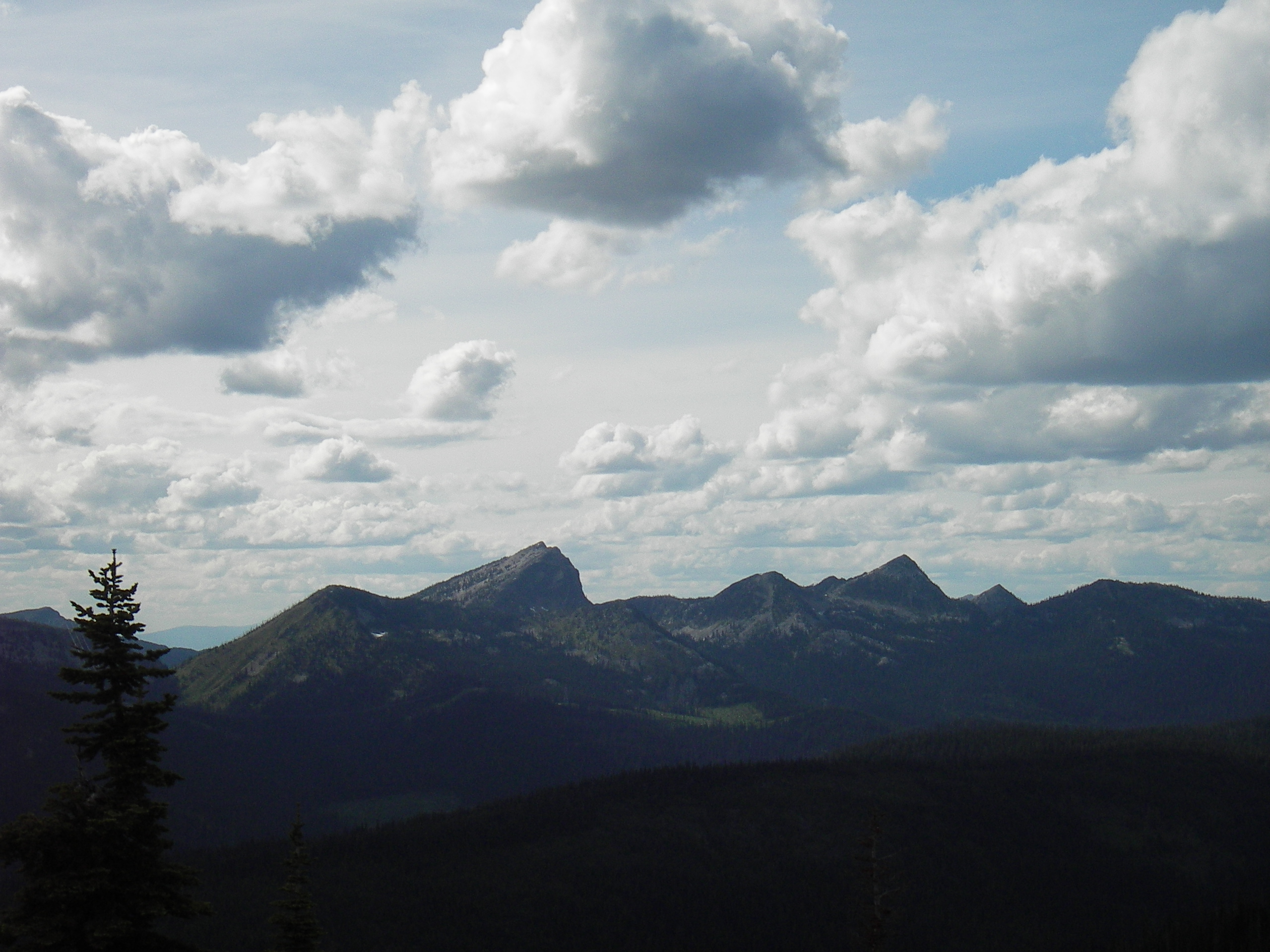
Glacier Peak, along with Mount Rainer, Mount Adams, Mount Baker, and Mount Saint Helens make up the five volcanoes of the Washington Cascades. Glacier Peak reaches an elevation of 10,541 feet, and has more than a dozen glaciers. It is not visible from any major populated area and is the most remote of Washington’s volcanoes; therefore, it has fewer visitors than the other peaks.
Old-growth cedar, fir, and hemlock line the North Fork Sauk Trail as it slowly gains elevation along the bank of the river. We passed the Mackinaw shelter after five miles and then reached the bend in the trail that would deliver us to White Pass. The pleasantly cool air of the river shore was soon replaced by startling heat as we climbed three thousand feet in three miles on unending switchbacks. I’m a lightweight hiker so I wasn’t excited about all the extra weight I had to carry in the shape of rope, mountaineering boots, an ice axe, and crampons.
Although I’m more of a hiker than a mountaineer I do try to get at least one glacier climb in per summer. I sure do enjoy climbing the big peaks of the Cascades. So the climb up the switchbacks nearly killed me. My dad walks crazy fast no matter what the weather condition or his physical conditions and I felt like I could barely get enough air into my congested sinus’ and lungs for my muscles to function. And in the breaks of the tree canopy where the sun had me like a cheesy casserole on the top rack of the oven, just inches from the red-hot broiler I was thinking about leaving myself for the wolves…but I made it.
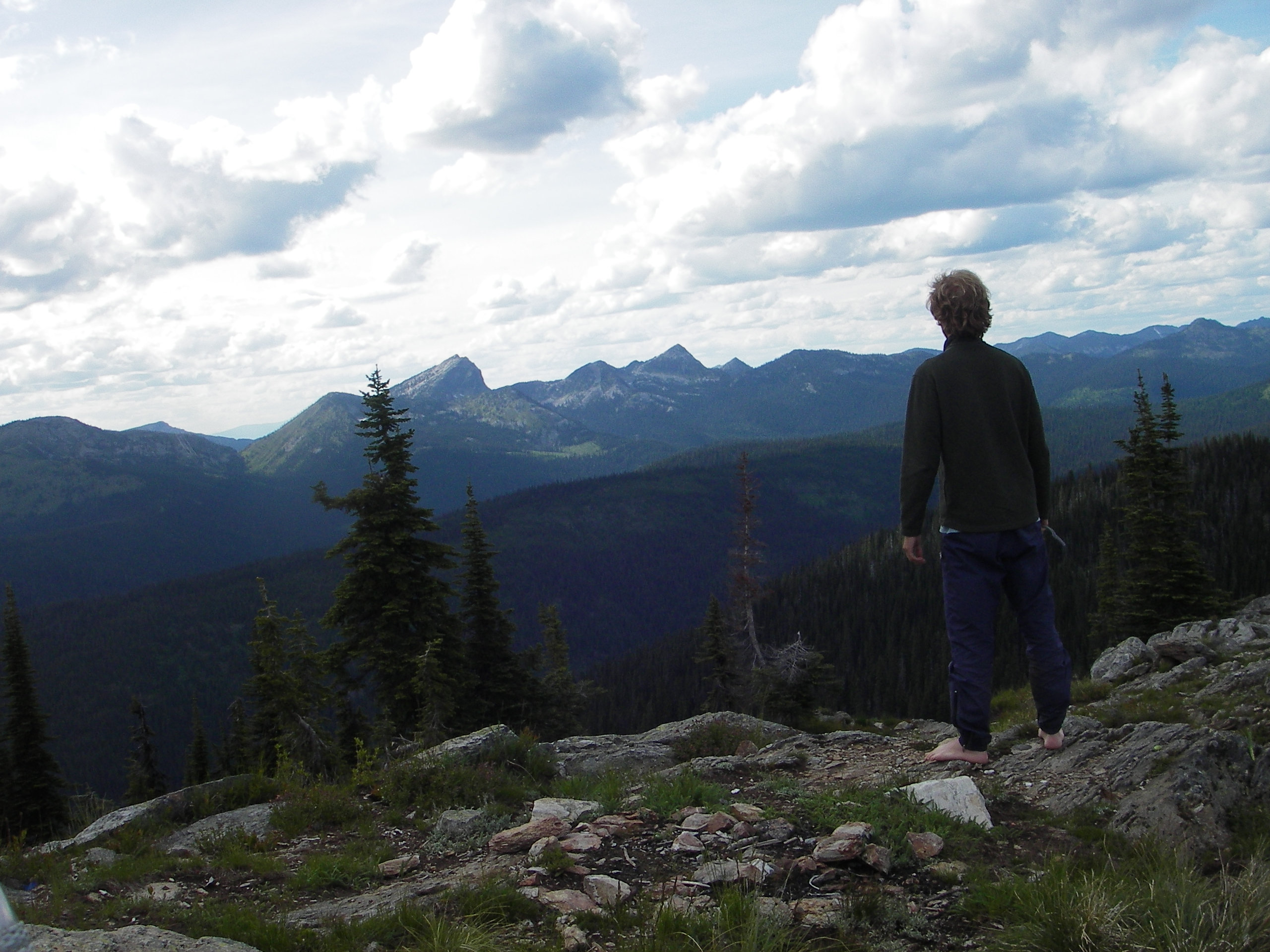
Up at White Pass, we took a sharp turn off the Pacific Crest Trail and took the “climbers’ trail” toward the mountain. This climbers’ route gets a lot of use and is in good shape; up the path about one hundred feet is where we had our first views of Glacier Peak. The trail ascends and descends more times than I was hoping and eventually comes to an end at the base of the peak in a jambalaya of boulders, scree, and sand. After a long day, we made camp on what looked like the last patch of sand around. I was like a worn out dog and I honestly don’t think I could have climbed one more hill, no matter what the size.
I brought a packet of Theraflu with me that eased my congestion and I slept like a log that night. In the early morning, I ate as quickly as possible by stuffing my face with handfuls of trail mix, dried fruit, and cereal. (I’m a long-distance hiker at heart and I don’t like to waste time not walking, dammit.)

There is no path through the rock and boulder field at the base of the mountain and there are cairns everywhere marking seemingly hundreds of different routes so we just did the best we could and eventually made it to the Cool Glacier where travel was much easier. Our guidebook said that instead of picking our way through the rocks it would be possible to bypass them by way of the glacier up on the side hill to our right. But global warming is a bitch and there wasn’t enough snow up on that slope to make a slushy.
We picked a great day for our summit attempt; the sun was bright and the wild was mellow. Past the boulder field, the route up is rather simple and easy to navigate. But like on any glacier climb one needs to be prepared as there were open crevasses and many spots where a fall would make the national news. We passed a few climbing parties, some heading up and some heading down. Those coming down were cheery and practically in awe of what they had just accomplished. Those going up looked miserable and like they were trying to breathe out of a coffee straw.
With very tired bodies, we slowly took off our crampons to ascend the last sandy slope that leads to the summit. We were the only ones up there and didn’t stay much longer than it took to look around a little, snap a few pictures, and sign the register. The wind was howling and too cold.
![Dad on Glacier Summit[1]](https://gonewalkingblog.wordpress.com/wp-content/uploads/2015/10/dad-on-glacier-summit1.jpg?w=736&h=552)
Travelling down the mountain was a blast and I glicaded and slid on my backside. I couldn’t feel my butt after a while, but I didn’t care as it sure beat walking. Back at our previous campsite, I crawled into my probably 110 degree tent and took a nap. I slept for about an hour until I was just too sweaty and hot to stay in there any longer. By this time Dad’s knee was finally starting to bother him so we didn’t make it all the way back to the trailhead and instead camped at White Pass. That was Saturday night so the entire area was packed with backpackers. It was a pleasant evening only spoiled by the climbing party camped very close to us and camped on sensitive vegetation. The guide talked and talked about all the peaks he had bagged for nearly four hours straight. The two men he was guiding barely got in a word. I thanked the high heavens he finally shut up when it got dark out because his voice was driving me bonkers.
We were the first group to leave in the morning and it was glorious heading down the switchbacks in the morning mist, especially compared to climbing up two days before. Hiking in the morning is as good as it gets in my book and I enjoyed every minute of the descent, even though I was pretty much running on fumes and struggling to breathe.
Back at the car, I had fortunately remembered to bring an extra change of clothes and some flip-flops for the long drive home. It was great getting out of those heavy La Sportivas and into a clean shirt. We took a somewhat different route on the way home, spending more time on the Cascades Highway and traveling through 104 degree Omak.
During parts of the climb I thought there would be no way in the world I would ever climb Glacier Peak again. The North Fork Sauk Trail starts off at close to two thousand feet and for most people it is a three day adventure to get to the summit and back. It’s a much more physically demanding climb that Mount Adams, Mount Whitney, or even Mount Rainer, but now that I’ve had some time to be nostalgic I’d do it again if I had the opportunity. Isn’t that how mountain climbing always is.
![Glacier Peak from Basin[1]](https://gonewalkingblog.wordpress.com/wp-content/uploads/2015/10/glacier-peak-from-basin1.jpg)

![Dad on Glacier Summit[1]](https://gonewalkingblog.wordpress.com/wp-content/uploads/2015/10/dad-on-glacier-summit1.jpg)

Recent Comments